
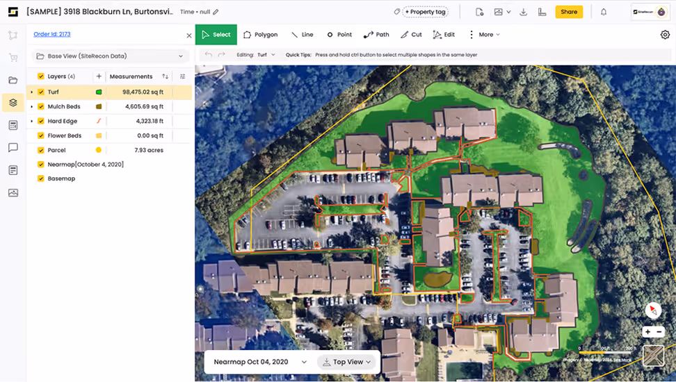
Multi-Layer Property Service Maps and Measurements
One Property. Every Service. Mapped in Minutes
SiteRecon's multi-layer service mapping lets you capture turf, softscape, hardscape, irrigation, snow routes, tree, and plant health zones in a single session—giving estimators, crews, and account managers one source of truth for every property you service.

Complete Property Intelligence Across Every Service Line
Distinct Layers
Build comprehensive property maps with dedicated layers for mowing zones, bed maintenance, irrigation coverage, parking lot snow routes, sidewalk clearing, and plant health care areas. Each layer stores its own measurements, notes, and service specifications—no more flipping between files or spreadsheets.
Unlimited Applications
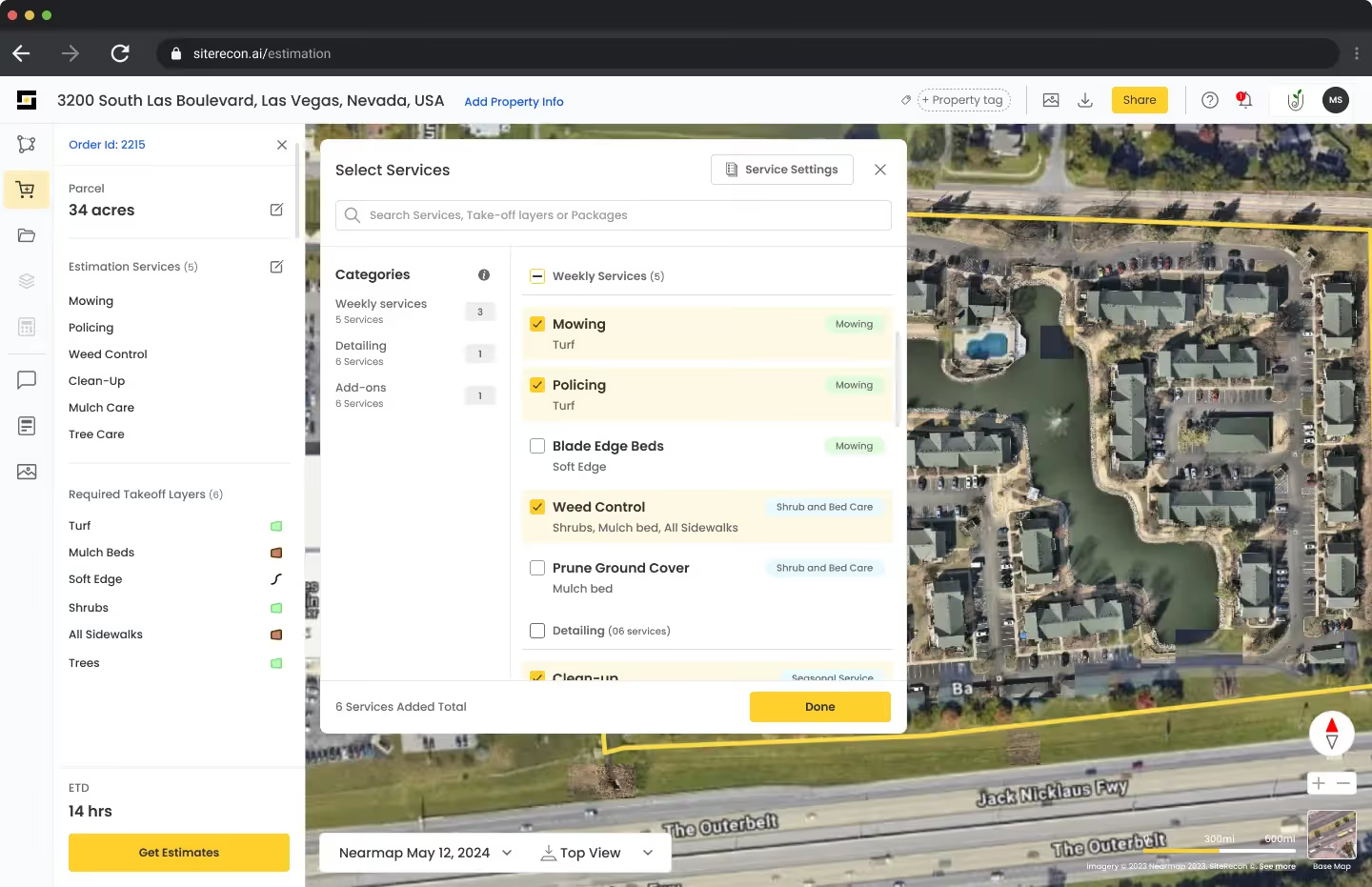
Measure once and apply everywhere. A single property mapping session gives your landscape maintenance team turf square footage, your snow crew parking lot dimensions, and your enhancement team bed and hardscape measurements—all from the same source file.

Shareable Data
Property intelligence shouldn't live in one estimator's head. Multi-layer maps sync across your entire organization so sales, operations, and field crews all work from identical property data—whether you're quoting spring cleanups or winter snow contracts.

Instant Measurements
Measure turf, hardscape, beds, parking lots, and snow routes remotely using satellite and aerial imagery. Get accurate square footage and linear measurements in minutes instead of hours—no truck rolls, no wasted windshield time.
Multi-Layer Service Mapping
Create detailed property maps with distinct layers for every service type—mowing zones, irrigation coverage, snow priority routes, bed maintenance areas. One measurement session captures everything your crews need to estimate and execute.
Bulk Property Processing
Measuring a portfolio of 50 properties? Upload your list and get complete takeoffs back fast. Scale your estimating capacity without adding headcount—perfect for large commercial bids and multi-site contracts.
What SiteRecon clients are saying about Multi-Layer Property Service Maps and Measurements
"After verifying SiteRecon’s accuracy on 20 properties, we were fully confident in the system. As a result, we’ve reallocated resources to higher-value activities and we can now focus on our clients’ pain points rather than rushing to complete bids."

Benefits and ROI Results

Aspire
Lorem ipsum dolor sit amet, consectetur adipiscing elit. Suspendisse varius enim in eros elementum tristique. Duis cursus, mi quis viverra ornare, eros dolor interdum nulla, ut commodo diam libero vitae erat.
BOSS
Lorem ipsum dolor sit amet, consectetur adipiscing elit. Suspendisse varius enim in eros elementum tristique. Duis cursus, mi quis viverra ornare, eros dolor interdum nulla, ut commodo diam libero vitae erat.
Benefits and ROI Results
Eliminate redundant site visits and duplicate measurement sessions across service lines. Contractors using multi-layer mapping report cutting total estimating time in half while increasing bid volume.
When maintenance, snow, and enhancement teams all pull from the same property layers, you eliminate costly errors from mismatched measurements and conflicting data sources.
One estimator with multi-layer mapping can handle the workload of two or three using traditional methods. Grow your bid capacity and take on larger multi-service contracts without proportional increases in estimating staff.
Explore other features
Frequently Asked Questions About Multi-Layer Service Mapping
SiteRecon supports dozens of custom layers per property. Common layers include turf/mowing zones, hardscape areas, planting beds, irrigation coverage, parking lot snow removal, sidewalk clearing routes, tree and shrub inventories, and plant health care zones. You can also create custom layers for specialty services like sports turf management, erosion control, or seasonal color rotations.
Traditional workflows require re-measuring the same property for each service line once for mowing, again for snow, again for irrigation. Multi-layer mapping captures everything in a single 10-15 minute session. Contractors typically report 50-60% reduction in total estimating time across multi-service accounts, plus elimination of measurement discrepancies between departments.
Yes. Multi-layer maps are cloud-based and sync across your entire organization in real time. Estimators can build initial layers, account managers can add notes and service specifications, and operations can review measurements before crew dispatch, all working from the same property file with full version history.
In many cases, Yes. SiteRecon integrates with Aspire, Boss, Real Green, and other platforms to preserve your layer structure during export. Each service layer can map to the corresponding module in your business software, so turf measurements flow to maintenance estimates while parking lot data flows to snow contracts without duplicate data entry.
This is one of the biggest advantages. Capture complete property intelligence during any season and apply it year-round. Measure a commercial campus in July and use those same parking lot and sidewalk layers to quote snow removal in October, without waiting for snowfall to walk the site or scrambling to measure before the first storm.
Get Started Today
Ready to measure once and quote every service from a single property map?