Measure Any Property From Your Phone: How Scout AI + SiteRecon Plato Changes Field Estimating
Scout AI measurements are now in the SiteRecon Plato mobile app. Get 95–98% AI accuracy on any property — before you leave the job site. 2 free measurements/month.

Key Takeaways:
An AI property measurement app lets outdoor services contractors measure any property's area, boundaries, and zones directly from a mobile device — with AI-powered accuracy — before leaving the job site. SiteRecon's Scout AI, now available inside the Plato mobile app, delivers 95–98% measurement accuracy from iOS or Android on any commercial or residential property, with no manual tracing required.
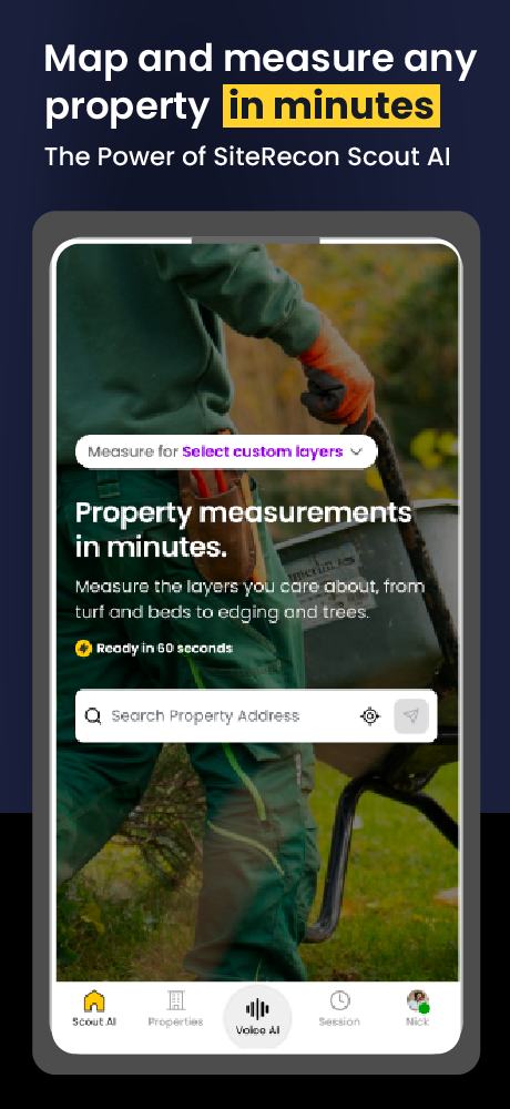
There's a step in almost every outdoor services estimating workflow that nobody talks about as a problem — because everyone has always done it this way.
You visit the property. You take notes, maybe some photos. And then you drive back to the office to measure it.
That gap — between the site visit and the measurement — is where bids get lost. It's where proposals sit unfinished while a competitor's is already in the client's inbox. It's where "we'll get you a number by tomorrow" becomes the reason you didn't win the job.
Scout AI is now in the SiteRecon Plato mobile app. Which means that gap is gone.
What Is an AI Property Measurement App?
An AI property measurement app uses machine learning and satellite or aerial imagery to automatically calculate property dimensions — area, boundaries, surface zones — without manual tracing or physical measurement. Unlike traditional GIS tools that require a trained estimator at a desktop, modern AI measurement apps run the same calculations from a phone in the field, in seconds.
The most accurate AI measurement platforms, like SiteRecon's Scout AI, achieve 95–98% accuracy across residential and commercial properties up to tens of acres — a margin comparable to professional survey-grade measurement for most estimating purposes.
What the Plato Mobile App Does
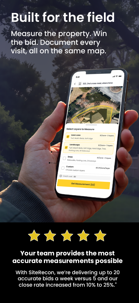
SiteRecon's Plato mobile app is the field operations layer of the SiteRecon platform — available on iOS and Android. It gives contractors access to their property database, account records, and — now — Scout AI measurements from any device, anywhere.
Before this launch, Scout AI was a desktop-first tool. Estimators ran takeoffs at the office after site visits. Now, measurements happen at the property. The workflow collapses from two steps into one.
How Scout AI Measurements Work Inside Plato
The workflow is three steps:
- Open Plato and navigate to any property by address or account record
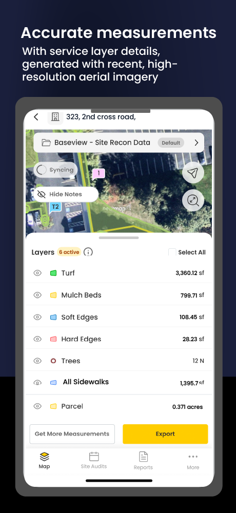
- Tap to run a Scout AI measurement — the AI engine identifies property boundaries, surface types, and zones automatically
- Review your measurement results and export directly to your estimate template — before you leave the property
From first tap to populated estimate: under 3 minutes for most properties.
What Changes for Your Business
The impact isn't just speed — it's the elimination of an entire workflow stage:
- Same-day proposals: site visit and proposal sent in the same morning
- Higher bid volume: more proposals submitted per week without adding estimating headcount
- Better accuracy: 95–98% AI measurement vs. manual estimates subject to human error
- Faster win rate: contractors using Scout AI see an average 27% improvement in win rate
According to the National Association of Landscape Professionals, faster proposal turnaround is consistently cited as one of the top competitive differentiators in contractor bid success — particularly for commercial accounts where multiple firms are bidding simultaneously.
Who This Is Built For
Scout AI in Plato is designed for any outdoor services company that measures properties as part of its estimating process:
- Landscaping companies bidding residential and commercial maintenance contracts
- Snow removal contractors measuring commercial properties for seasonal proposals
- Lawn care operators scaling their estimating process without adding office staff
- Tree service and grounds maintenance companies managing multi-zone properties
2 Free Measurements Per Month — Try It Before You Commit
Every Plato user gets 2 free Scout AI measurements per month — up to 10 acres each. No credit card required. Download the app, measure a property you know, and compare the result to your existing process.
Try Scout AI in Plato — 2 Free Measurements Per Month
Up to 10 acres each. No credit card. No commitment. Download Plato and measure before you leave the property.
FAQs
An AI property measurement app uses machine learning and aerial or satellite imagery to automatically calculate a property's area, boundaries, and surface zones from a mobile device. It eliminates the need for manual tracing or in-person physical measurement. SiteRecon's Scout AI is an example, delivering 95–98% accuracy on any commercial or residential property from iOS or Android.
Scout AI delivers 95–98% measurement accuracy on mobile — the same as the desktop platform. Accuracy is determined by the underlying AI model, not the device used to access it.
Plato supports offline use in low-signal areas and syncs your measurement data when you reconnect. For the initial Scout AI measurement to run, an internet connection is required to process the AI model.
Yes. Every Plato user gets 2 free Scout AI measurements per month, up to 10 acres each. No credit card is required. Free measurements reset monthly.
Scout AI in Plato is used by landscaping companies, snow removal contractors, lawn care operators, tree service companies, irrigation contractors, and grounds maintenance firms — any outdoor services business that measures properties as part of estimating.
Take your business to the next level
Find out how SiteRecon's AI remote takeoff and land measurement tools can speed up pipeline, improve bid accuracy and increase sales