
Landscaping takeoff software
Automate your measuring process with SiteRecon
Help your sales team deliver their best by removing the administrative burden of measuring sites by hand. Utilize fast and accurate AI measurements to justify your estimates to the prospect, stand out from the competition, and close 2X more.
Measure lawns in 30 seconds
Measure commercial sites in a few hours
Measure large portfolios in a week

Sell more landscaping jobs with takeoffs on autopilot
Put out more bids on the street with faster takeoffs and justify your pricing to the prospects
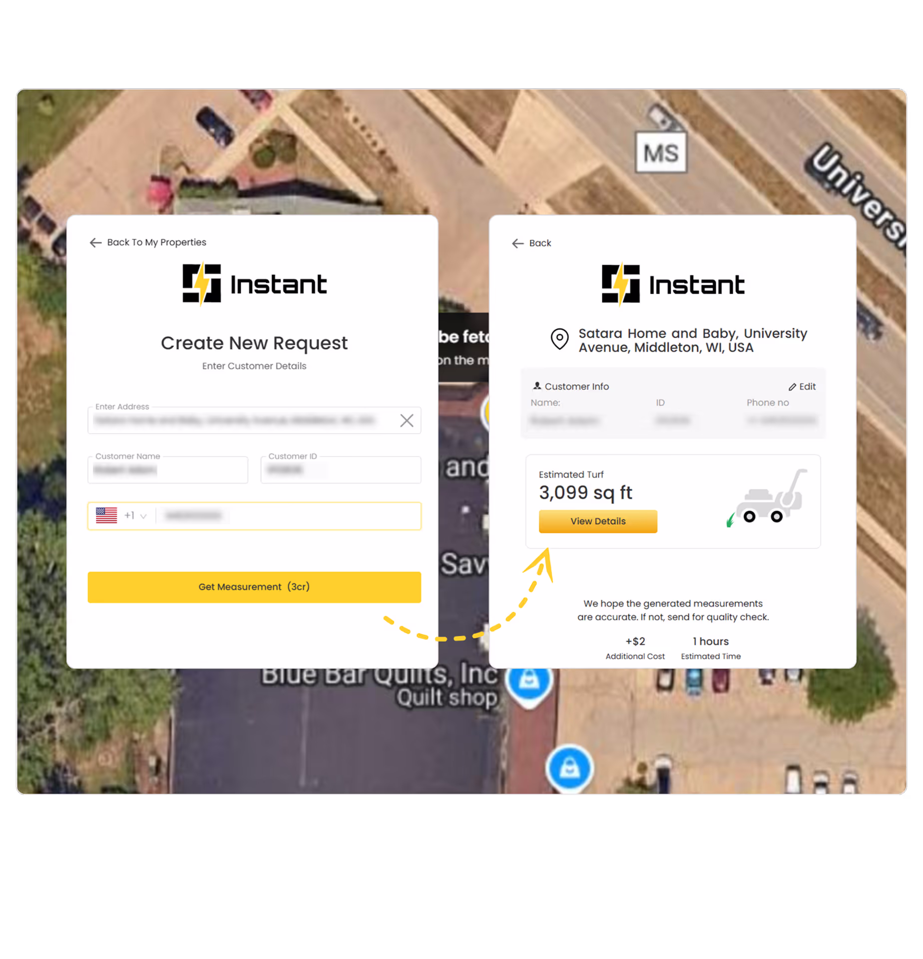
Instant Quotes for lawn care
Give quotes on the first call whenever the prospects call in—no site visit, no waiting. With Instant AI, measure any lawn in just 30 seconds and instantly generate a quote while still on the call.

Measure Commercial sites within hours
No more back breaking work to measure large commercial sites. Let SiteRecon do the heavy lifting for you and measure sites in a few hours
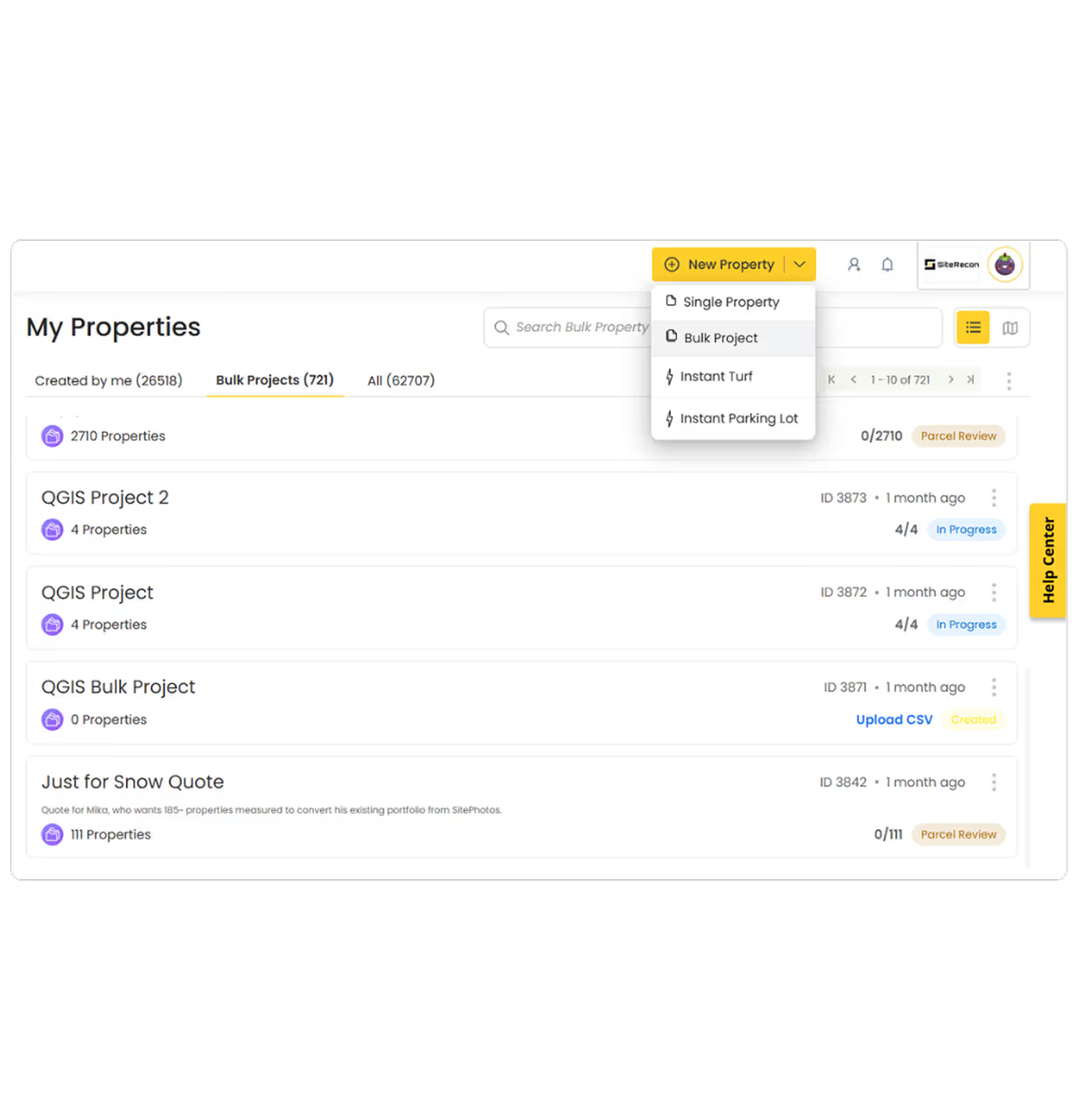
Measure large portfolios in days
Measure thousands of RFP sites in one go in less than a week. Eliminate manual takeoffs, accelerate bid timelines, and free up estimators to focus on pricing and strategy.

Get HD shareable maps
Download your maps in large print sizes A4, A3, A2, Arch D and Arch E
Download high-resolution maps in large print sizes A4, A3, A2, Arch D, and Arch E. Use them for client presentations, crew instructions, or internal reviews—clear, detailed, and ready to share.
Integrate with your CRM
Keep the data flowing seamlessly
SiteRecon offers open APIs which allow you to integrate it with your CRM or ERP

What our customers say about us


FAQs
Landscape takeoff software automates the process of measuring properties for landscaping jobs. It uses satellite imagery, parcel maps, and AI to generate accurate measurements of turf, beds, and hardscapes—eliminating the hours of backbreaking work that goes into measuring properties manually - with a measuring wheel or a measuring tape.
SiteRecon’s takeoffs extremely accurate which is the reason why SiteRecon is a trusted mapping partner for 5 out of the top 10 LM150 companies. The AI measures from high-resolution aerial imagery and parcel boundaries, ensuring consistency and precision across every property. Then the AI output goes through two Quality Assessment cycles where real human cartographers look at the data and refine it to meet SiteRecon’s high data delivery standards.
Landscape takeoff software is ideal for commercial landscapers, lawn care companies, and estimators who handle multiple bids each week. It’s especially valuable for businesses looking to speed up proposals, increase bid volume, and improve pricing accuracy.
Yes. SiteRecon offers open APIs and integrates with popular CRMs and estimating software. You can export measurement data into templates or connect it directly to your workflow—reducing manual data entry and saving time.
With SiteRecon Instant, you can get lawn measurements in under 30 seconds. For large commercial properties or multi-site portfolios, takeoffs are typically delivered within 24–72 hours depending on your subscription plan and the size of the property
Get Started Today
Want to scale your business, control your margins, and get rid of chaos? Get started today!