
Property Takeoffs Shouldn't Be Hard. Now They're Not.
Capture accurate AI measurements in minutes, respond to more opportunities, and grow revenue without adding overhead.


Why Landscaping Pros love SiteRecon
Discover how industry leaders have transformed their operations with SiteRecon, achieving remarkable efficiency and growth.


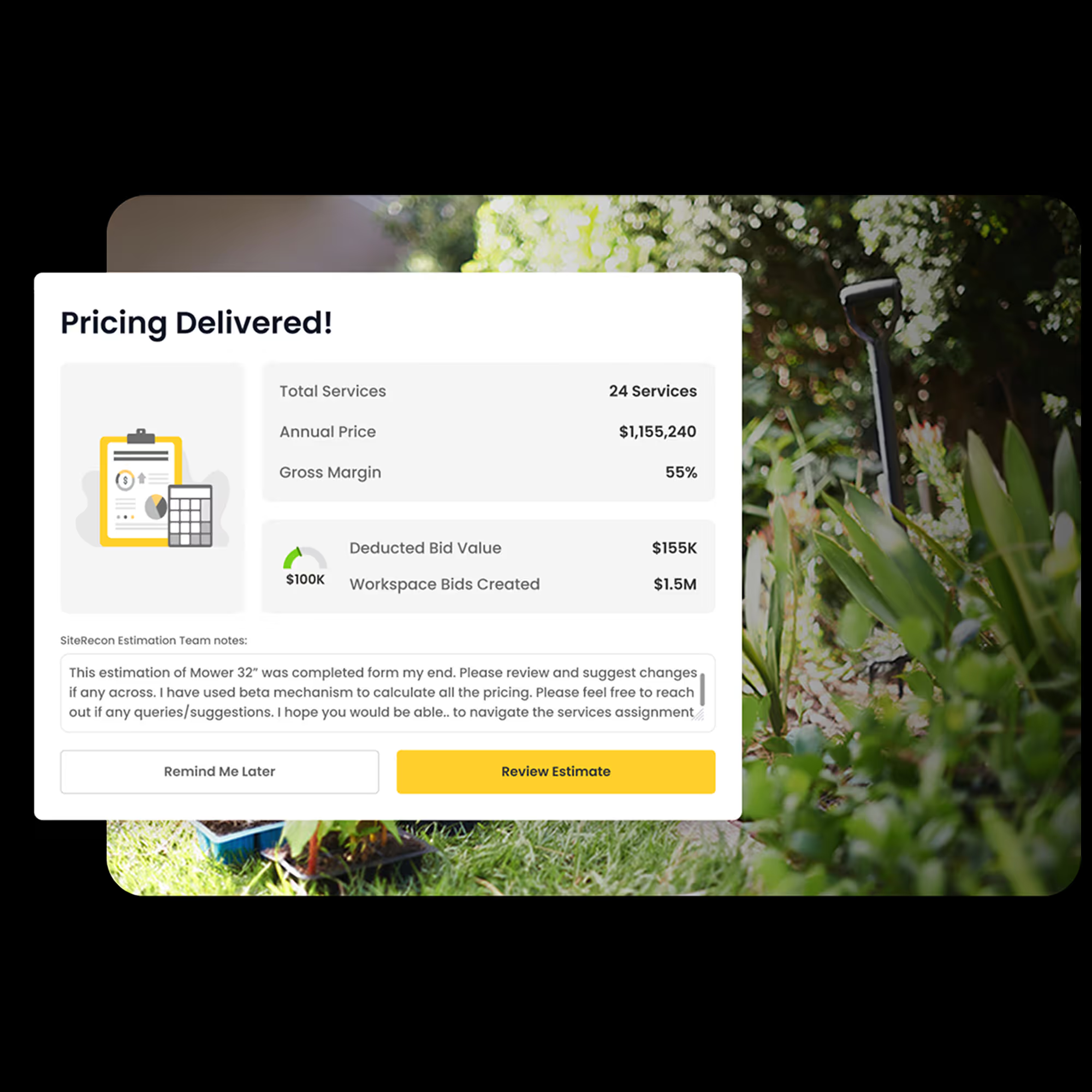
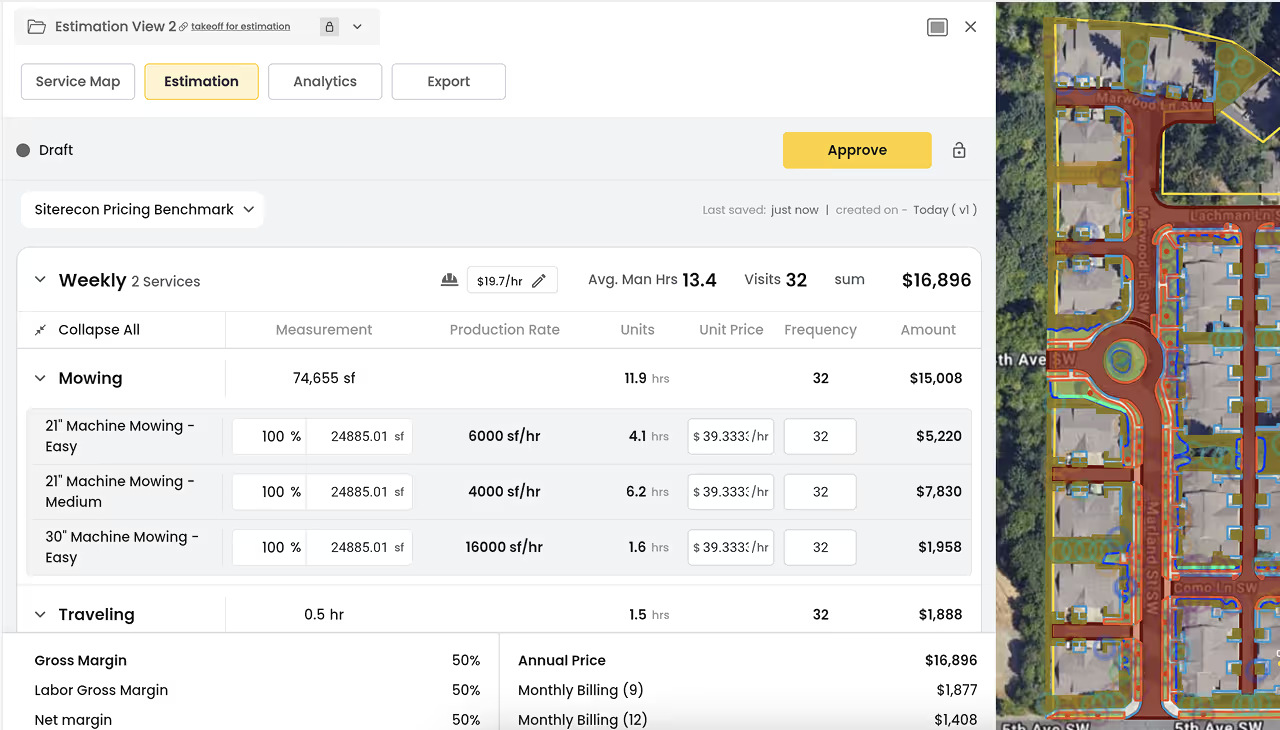
Win more deals without lowering your prices
Impress prospects with detailed site maps, precise estimates, and professional site condition reports. Communicate with clarity and build trust from the start—stand out in the competitive market without wasting time on manual processes.
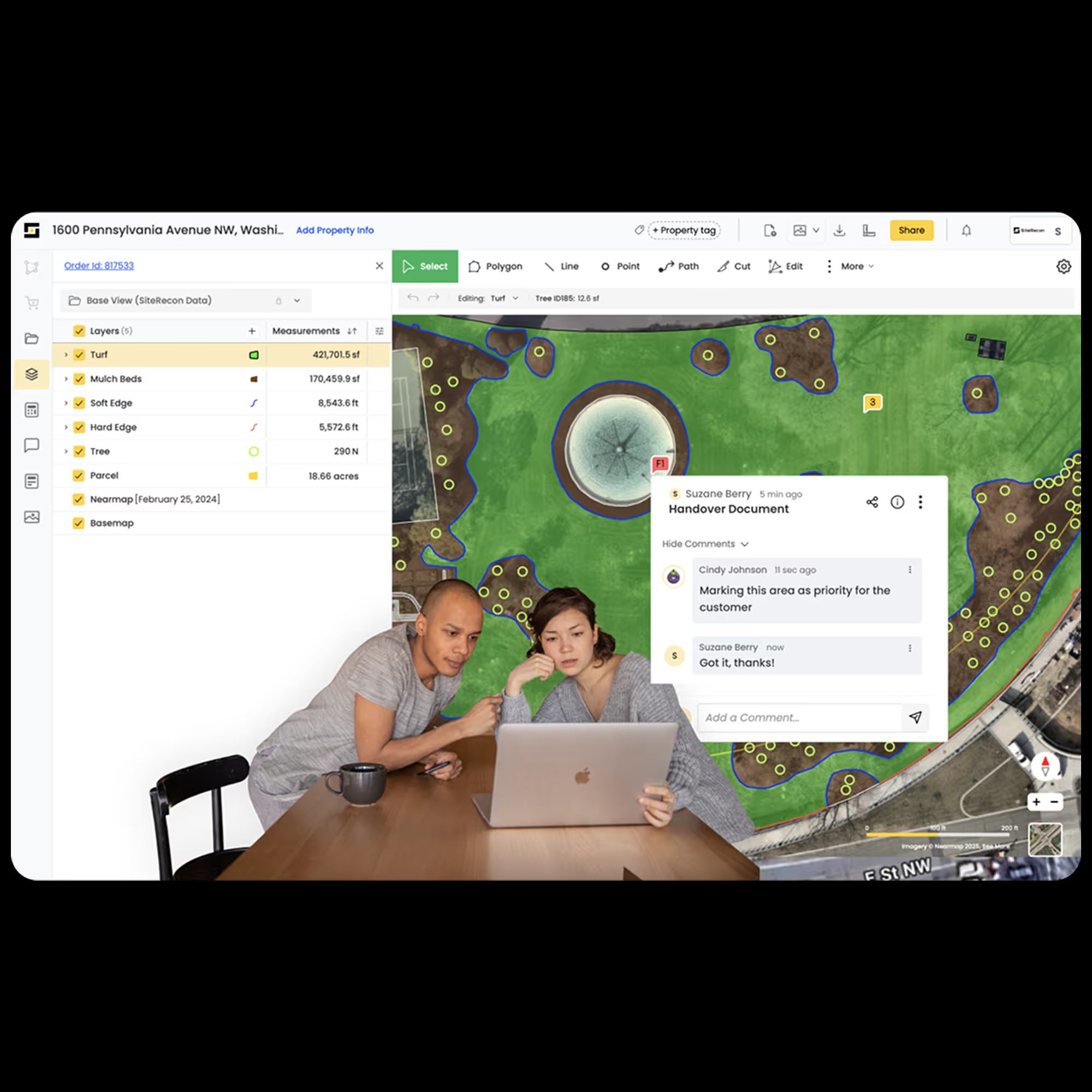
Execute clean handoffs without any leakage
Document enhancement opportunities during site walks with geotagged notes and photos. Generate instant proposals to pitch ideas professionally and win approvals faster—unlock new revenue streams without adding complexity.
Sell enhancements faster
Document enhancement opportunities during site walks with geotagged notes and photos. Generate instant proposals to pitch ideas professionally and win approvals faster—unlock new revenue streams without adding complexity.

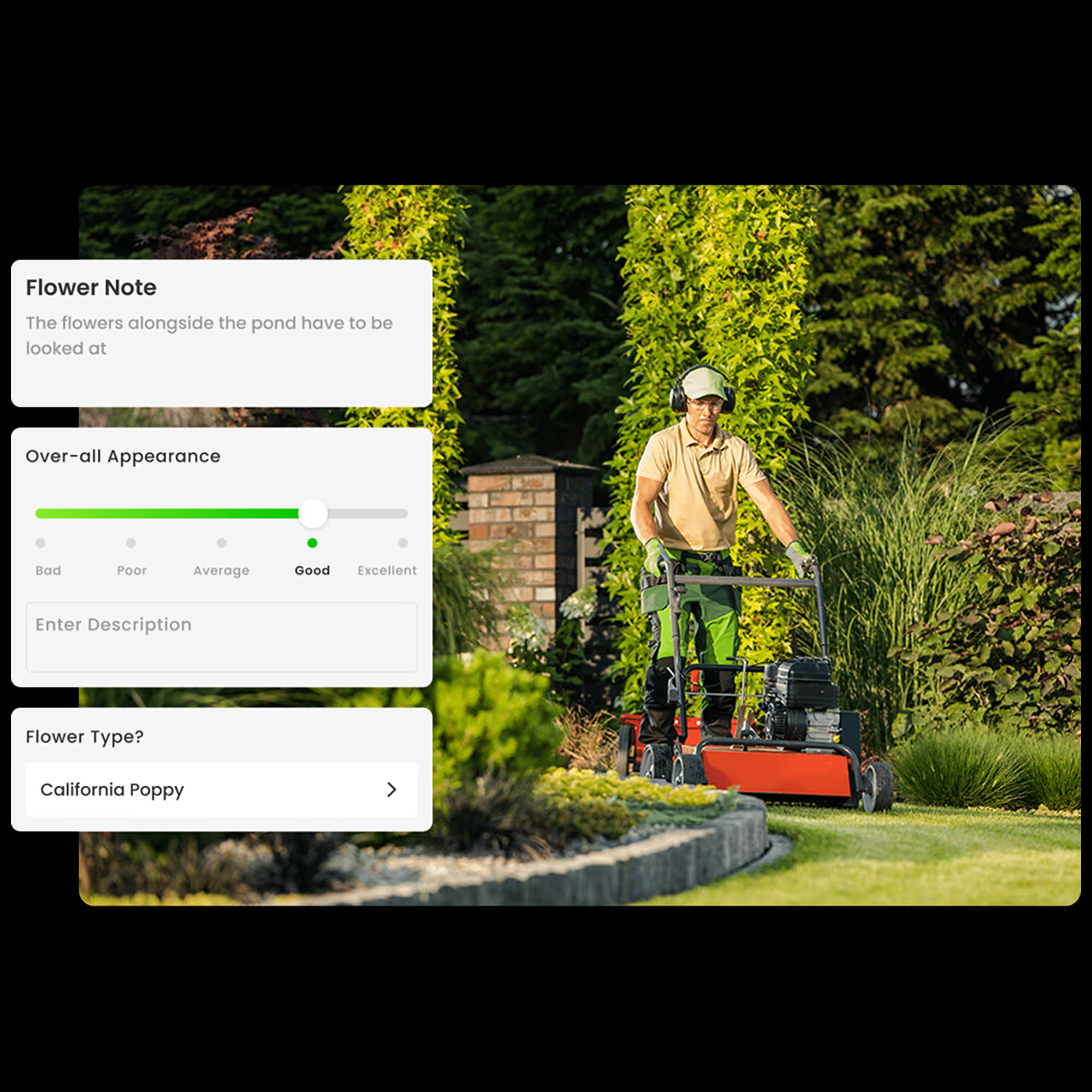
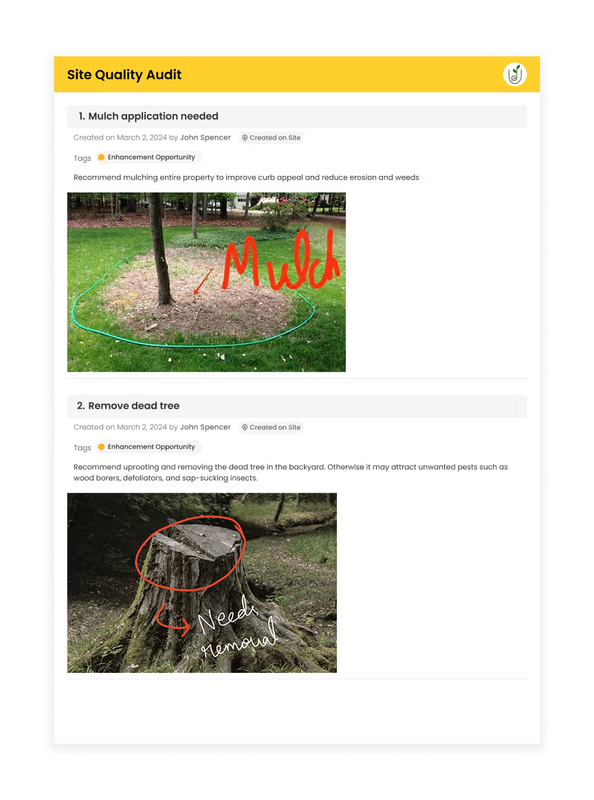
Deliver service that matches expectations
Conduct site quality audits effortlessly with ready-to-use templates. Track performance, highlight service quality, and address issues proactively. Strengthen customer relationships with data-backed insights—no miscommunication, no service gaps.
Retain customers with ease
Showcase service history and organized records during renewal conversations. Highlight your professionalism and consistency to reinforce trust and loyalty. Make switching vendors hard for your clients—without extra effort or guesswork.

SiteRecon Improves Every Part of Your Landscape Business
Discover how industry leaders have transformed their operations with SiteRecon, achieving remarkable efficiency and growth.
%201.avif)

Grow your landscaping business with easy-to-use mapping tools
SiteRecon takes decades of industry expertise and converts them into plug and play tools that you can inject into your business and grow faster
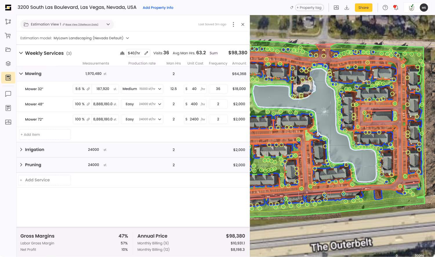
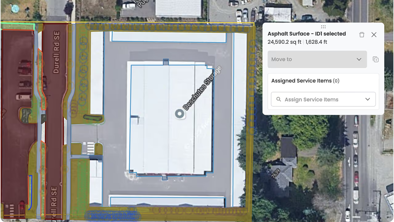
Automated takeoffs to bid faster
Utilize SiteRecon's powerful takeoff tools to measure properties quickly and accurately and knock out proposals faster
Crew Performance Dashboard
Stay on top of your service quality
Site Inspection dashboard
Monitor the workload of all your Account Managers from one place
.avif)

Stay Ahead in Landscaping: Explore, Evaluate, Excel
Blogs for discovery, decision-making, and growth.


Get Started Today
Want to scale your business, control your margins, and get rid of chaos? Get started today!